Powered By Blogger

Tuesday, August 31, 2010

GPS Blog Summary

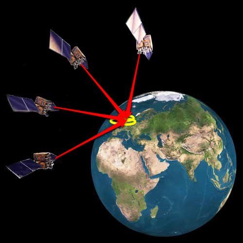
My blog has focused mainly on the different aspects of society and business that a new technology like global positioning systems can affect, whether it is positive or negative. Through my research and writing I have come to conclude that GPS has been a huge benefit to American society, whether you are in the military, law enforcement, a business person, a land surveyor or just someone who enjoys exploring new places and travelling. The fact that GPS is so useful and applicable to so many different people creates a beneficial production and consumption environment. Along with this, many industries have flourished due to this technology such as logistics companies who use it to predict the time and place of different shipments and processes as well as industries like Google who are using GPS to create new innovations for consumers like mobile maps that help expand their corporation’s capital. GPS itself has also served as a model for other computer program systems, even if they do not use the global positioning system with satellites per say. With all of these advantages, the only issue I came across when researching global positioning systems was the possible violation of privacy. As we all know, GPS has the amazing ability to pinpoint a location anywhere in the world, at anytime of the day whether you want it to or not. Although the legality of law enforcement to use GPS to track suspects is decided by district courts, it is still up to you the consumer to decide whether or not you would like to have a GPS included in your new car, cell phone or even just be an owner of a hand held model that can provide you with a number of advantages, but also monitor all of your locations day and night. 

Friday, August 27, 2010

Navigating around mobile GPS


GPS can be found on many new electronics, but which one is the best for you? I saw this video which is a good, quick overview of the newest mobile GPS. There are always the classic hand held GPS that are very easy to read and navigate while driving, however with the addition of advanced mobile services their prices can be a lot higher than most consumers will pay for. One example is the Garmin Nuvi 1690 that has impressive accommodations such as Google local search, real-time traffic, gas prices and weather. However, this particular product sells for about $499. Google had introduced a GPS application for mobile phones, but it turned out to be difficult for drivers to use. After this, Wisepilot, another online mobile GPS, was introduced for Android mobile phones which at $70/year was a much more affordable than Garmin and easier to use than Google. In turn, this new GPS became a huge competitor for them. Another option is a GPS navigation add-on, like the Dual XGPS 300, which cost around $150-180 and can turn an ordinary electronic gadget like an iPod Touch into your newest navigation tool. There are a number of online mobile GPS for consumers to try and with the competitive business market and numerous technological advancements you should be able to find an affordable one that suits you best!

Wednesday, August 25, 2010

Getting Lost and Found in GPS Technology


Reading both “The Acceleration of Tranquility” and Digital Capital have caused me to re-evaluate how I see the future of GPS technology, business and our quality of life. For example, when I read Digital Capital I thought back to the first time I had ever encountered a hand-held GPS. My older brother got one as a gift eight years ago and it was very complicated took a group effort to figure out. I then thought of the GPS that I got for Christmas last year and it was so simple and user-friendly compared to his! The evolution of global positioning systems has not only been key to the technological aspect of the product, but also to the business aspect. From what I gathered from Digital Capital, I believe this evolution makes the product more accessible and understandable which increases consumption. Along with the increase of consumption, “distributive networks” have benefited from the accessibility to GPS. This has created a new niche for the shipping and trucking branches of business that are now known as logistics, which are vital to many companies.  Like the evolution that Digital Capital has expressed, “The Acceleration of Tranquility” painted two pictures that compared life with advanced technology to life without it. The description of the time of great technological advances had its bonuses and drawbacks, just like the evolution of the GPS. Today GPS is more accessible than ever but with that accessibility comes the increase of GPS placement and usage that could possibly be an invasion of privacy. In the description of a simpler time, there was no immediate feedback from correspondents. When I compared that to global positioning systems, I thought about my travels before I had a GPS in my car and how immediate directions were not available, which for me made getting lost part of the fun and adventure of travelling. Some of the best stories my friends and I have are from who and what we encountered while we were trying to find our way! These readings have made me realize that although technological advancements have been great for consumption and business, you can lose some of the fun that comes with not knowing someone’s response or where you are… at least immediately!

Friday, August 20, 2010

GPS & Land Surveying

One of the most important ways global positioning systems have improved government capabilities is through the impact it has had on land surveying. Land surveying has been around for centuries, including in ancient Egypt where a rope and geometry calculations were used to determine an accurate position of the surveyor and the terrestrial points such as mountains, valleys and hills that were near the survey location.The government has always seen the importance of land surveying and Federal Government surveyors, known as cadastral land surveyors, have been making maps for a number of years. They are able to create topographical maps, land surface maps, water & other natural resource maps as well as fault line maps for the government. With the invent of GPS, land surveying has become a much more simple task with more accurate results.The global positioning system, which is stationed on a tripod, is able to find points using the satellites that send the information the the surveyor's computer, where the data can determine the position of the points to the closest millimeter. Here is a video of a land surveyor in action in Santa Clara county!


Wednesday, August 11, 2010

Organizing Information with GPS

As I was browsing information about global positioning systems and how they relate to business and society this week, I came across an article that I feel resonates with the importance of technological organization and how GPS has been an important addition to it! The article entitled “GPS for Your Organization: The Art and Science of the Enterprise Information Map” begins by discussing how GPS and EIM (enterprise information maps) are able to work together to locate, manage and protect high-risk information. Enterprise information maps were developed to advance an organization’s information management potential and to protect high-risk and valuable information by identifying what information you have, where it is, and whether or not it is truly risky enough to make the effort to protect it. There are 3 aspects to the idea of EIM, which include information space, users and controls. The information space that is accessed has thousands of locations such as networks, shared drives, databases and business applications that are carrying so much important information for a business organization. Users are all the people that have access to and can modify this information and the controls are a “master ground station” that classifies what information needs to be protected. The EMI works by using these elements to create your own information “GPS” and “GPS snap shot,” which is a general overview of all the information as well as the connections and interactions between said information. This information “GPS” is much like any GPS with map display, format, navigation and accessories. The map display allows you to manage the specific details you would like to have included in your “snap shot” overview. The format then facilitates who gets access to what information. The navigation facet allows you to view your “GPS snap shot” and helps you find your way through all of the complicated data systems and locations. Accessories are how the EIM can be acquired in various sizes with different amounts of information and detail storage. This idea of having a “GPS” for your information has been an important way to learn what you know and what you need to know when it comes to managing any organization’s information. This can ultimately cut costs and create an even more efficient organization. If you would like to check out the article here’s the URL: http://www.metrocorpcounsel.com/current.php?artType=view&EntryNo=9252

Sunday, August 8, 2010

Military Society & Global Positioning Systems


Although this far my blog has focused on the relationship between global positioning systems and law enforcement in the U.S., there are many more facets of society that the development of GPS has affected. It is common knowledge that global positioning systems are run by satellite signals that can track a system anywhere in the world. With this kind of precise technology and advanced applications, the military was able to create more organizational ties than ever before. Initially global positioning systems were produced specifically for military use and after observing the amount of benefits it had provided, it was clear that these benefits could be applicable to civilians as well. The applications that are used by the military today are navigation, target tracking, missile and projectile guidance, search and rescue, reconnaissance, facility management and nuclear detonation detectors. Military society is tight-knit and lives are often on the line, so these GPS applications were able to increase military personnel safety and efficiency creating a stronger institution. Navigation can help soldiers who are in unfamiliar, dark and rugged terrain obtaining where they are and where their convoys are located. Target tracking is also important because potential targets must be continuously tracked to determine whether or not they are hostile and if preventative action must be taken. GPS has also been instrumental in missile and projectile guidance helping the military to accurately hit the correct targets. However, one of the most crucial military GPS applications is search and rescue. It is able to provide the location of casualties and survivors lessening the emergency response time. Currently the U.S. Air Force is developing a Combat Survivor Evader Locator system that can trace drowned aircrew members more efficiently than ever. Reconnaissance is another vital application because it is necessary for the military to be able to plan operations and training through rapidly updated maps. These show the placement of weapons and targets accurately on a precise gridlocked map. The military organization also uses GPS to help facility management. The military manages a number of large bases that are distributed throughout the world and global positioning systems allow administration to create an accurate base map for all of these areas. Finally, GPS are used as nuclear device detonators. The satellites carry a set of these detectors with a number of sensors that are able to discover these devices before anyone gets hurt or killed. All of these global positioning system applications provide critical intelligence that in turn creates a stronger and more efficient military society, which is where the sociological aspect of this technology comes into play. Military sociology discusses the military as a community with shared interests like goals, values and survival in combat. These shared interests are reflected in the purpose and use of the specific military GPS applications, which ultimately interconnects the military community at a higher level. 

Thursday, August 5, 2010

Production, Consumption and Global Positioning Systems


The Industrial Revolution spurred a complete change in the production of material goods and who has access to these goods. Many new technologies are oftentimes unavailable and expensive. GPS technology was at one point a rarity and was only obtainable by wealthy people and industries. Similar to what happened to a number of material goods in the Industrial Revolution, GPS has become affordable and available to the general public. It has even become included in many electronics that one would purchase without thinking of whether or not a GPS was included like cellular phones. Often times, upgraded and modern goods like motor vehicles are including GPS as a basic feature. With the lowered prices and increased availability, the federal government and military have become one of the largest consumers of global positioning systems. With the use of GPS, they are able to map the globe with geological surveys and also apply the knowledge gained from GPS to military reconnaissance. With the widespread accessibility to global positioning systems, law enforcement has been able to increase their efficiency and ability to track criminals and suspects, which I discussed in my previous post. Now that so many Americans have their own personal GPS and law enforcement has the ability to track people through this, personal privacy has once more been called into question. Where does the line get drawn on who it is legal to track and how can Americans and law enforcement come to a rational conclusion that can both keep society safe and maintain our right to privacy?